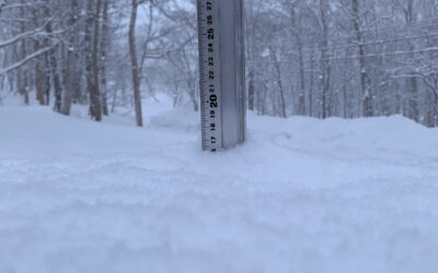
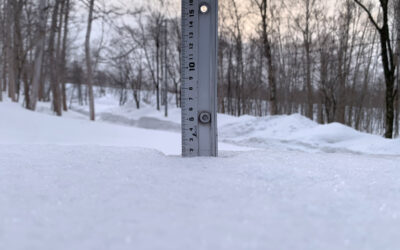
*2cm or more has fallen since 07:00 yesterday in Niseko. At 7:45 today the temperature was -4°C. Intermittent heavy snowfall yesterday definitely produced more than 2cm but the warmer temperatures melted much of the accumulation at lower altitudes. Clear skies overnight have produced the coldest morning since last winter. We have serious freeze thaw conditions and the roads will be very dangerous this morning. The forecast for new snowfall is not looking promising for the next week but this could change. The next snow report will come when the next dump graces us here in Niseko.
Useful information from other places
- Accumulative snow fall to date in Niseko, 16cm
- JMA’s six hour precipitation forecast, possibly the most accurate weather map
- Snow Forecast 6 day weather summary