Windy Night
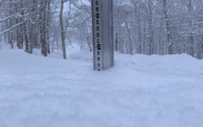
*13.8cm of fresh snow has fallen since yesterday morning and at 7:20am today the temperature was -2°C. After yesterday’s warming the wind came back last night and it looks like we could be in for storm conditions today.

Snow fall depth in Hirafu village, 24 February 2012
Useful information from other places
- Accumulative snow fall to date, 1,349cm
- Snow depth at the peak, 420cm
- Snow depth at the base, 230cm
- JMA’s six hour precipitation forecast, possibly the most accurate weather map
- Real time lift operations.
- The latest Niseko avalanche report.
What’s happening today
Conditions don’t look that good today so you might want to hold off until they improve and then try…
Snorkel – After a big storm of Niseko’s finest white powder snow you will need a snorkel as you descend down this ski run located in the Niseko Village ski ground.
Ukairo – The highest green ski run in all Niseko ski grounds and made up of switch back turns along a cat track in the Niseko Village ski ground.
Wonderland – It’s at the top of the Niseko Village resort and this red ski run is a true winter wonderland for skiers and snowboarders.
Namara – A red ski run that’s long, wide and open letting you drop down a large stretch of the Niseko Village ski ground.
That Spring Feeling
Although today looks like it’s going to be a typical Niseko stormy winter day, yesterday we got a taste of Spring.
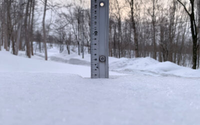
The town snow clearers must be catching up on work because they’ve started widening the roads again.

Wide roads again as last
…and we’re getting glimpses of spring scenery…

That Spring feeling
I missed this morning’s sunrise, but yesterday’s was something to remember…

Sunrise

Sol and Yotei
Snow Forecast
Get more information on Snow-Forecast.com.
Niseko snow fall data
The 360niseko snow fall data is licensed under a Creative Commons Attribution 3.0 Unported License. Feel free to use it for personal or commercial purposes and if you publish it please credit 360niseko by providing a link back to the website.