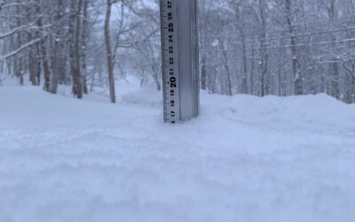
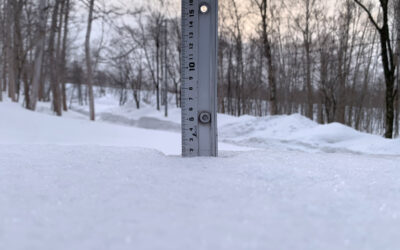
* 8.0 cm has fallen in the last 24 hours. At 5:08 am today the temperature was -6.9

Niseko Snowfall 03_01_2018
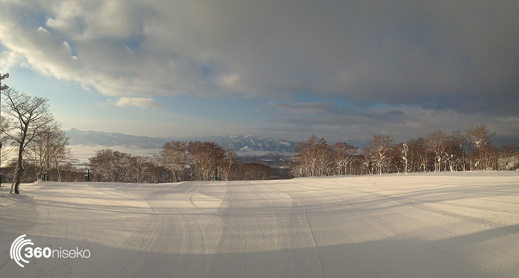
Snow has fallen overnight and while the conditions may be a little off the normal deep pow that we enjoyed for the bulk of December there is fresh snow and there will be even more up high. Temps yesterday swung around in a pretty wild fashion before dropping so the snowpack will have a few interesting layers in it as well that are worthy of note. Looking at the long range forecasts it’s hard to make a call on what will happen across the next few days leading into the weekend but it seems like a pattern of light snow with patches of sunshine so perfect conditions to get up and around the mountain and nail that classic “Mt Yotei in the background” shot for facebook or instagram. Further out on the forecast there is some major storm activity showing but they call it a forecast for a reason and lets not pin our hopes on a computer model just yet.
The live cam will give you an up to date look at Hirafu so have a peek now and then and you may even catch the snow falling!
Useful information from other places
-
-
- Accumulative snow fall to date in Niseko, 672 cm
- Snow depth at the peak, 320 cm
- Snow depth at the base, 145 cm
- Real time lift operations.
- JMA’s six hour precipitation forecast, possibly the most accurate weather map
- Snow Forecast 6 day weather summary
- The latest Niseko avalanche report.
- Please follow the Niseko Rules.
-
Live Web Cam from Hirafu Village
Snow Forecast
360niseko Snow Station Readings Disclaimer
The 360niseko now has 2 snow stations for the 2017-18 season in Higashiyama at 200m and 300m *The Hirafu Gondola is at 305m. Please be aware that this new reading is NOT in Hirafu village but a few kilometers down the road. There is always a deviation how and where the snow falls – the area is famous for micro climates and mini weather patterns. Some days there may be 10cm in Annupuri and 25cm in Hanazono and vice versa – some days 30cm of fresh snowfall comes down everywhere!! Altitude plays a big part as well so please don’t take the 360niseko snow readings as being definitive – the readings are what is outside our houses on the ground.