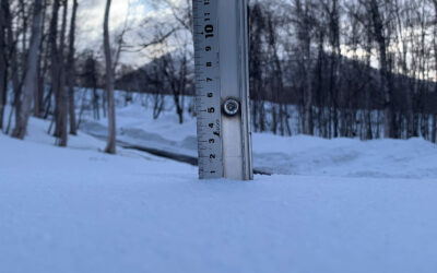
*14.5cm has fallen in the last 24 hours in Niseko. At 7:00 today the temperature was -10°C. The wild weather is definitely producing the goods here in Niseko with a continued coldsnap and constant snowfall. We have pretty much every winter weather warning in place this morning, blizzard, avalanche. With excellent snowfall over the last 24hrs we should have a reset on the mountain the only question is…where to go and what lifts will open?!? Get set for another few days of wind weather but as of midday today the winds will moderate… for anyone in the right spot at the right time when that happens – POWDA! Stay safe out there the roads will be nasty!!

Snowfall in Niseko, 12 January 2017
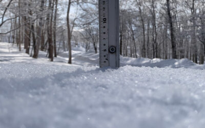
Niseko Snapshots
We weathered yesterdays wild weather but going cat skiing at The house of Powder.

Just another lap, 11 January 2017

Jarrod deep in contemplation, 11 January 2017
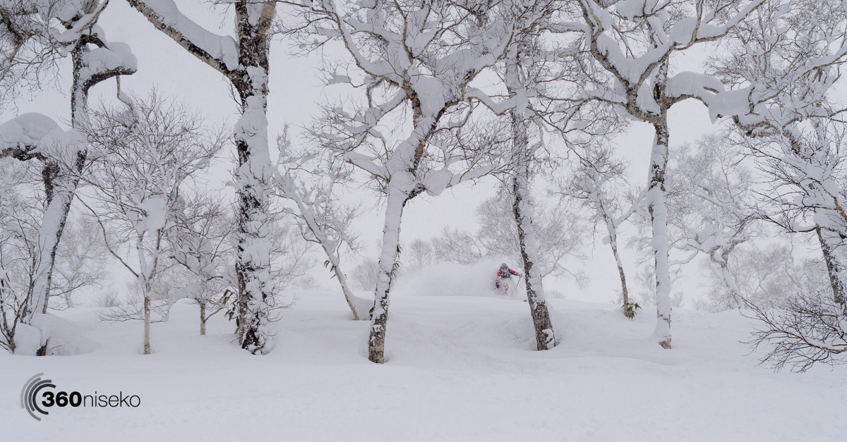
Jaimi chan ducking and weaving through the loaded Shirakaba trees, 11 January 2017

The hike out, 11 January 2017
Photos Glen Claydon Photography
Useful information from other places
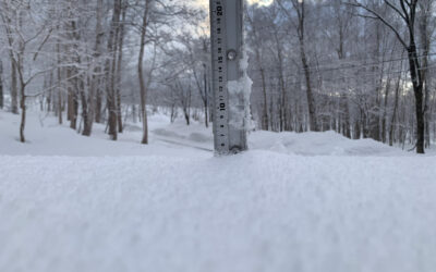
- Accumulative snow fall to date in Niseko, 345.5cm
- Snow depth at the peak, 260cm
- Snow depth at the base, 110cm
- Real time lift operations.
- JMA’s six hour precipitation forecast, possibly the most accurate weather map
- Snow Forecast 6 day weather summary
- The latest Niseko avalanche report.
Snow Forecast
360niseko Snow Station Readings Disclaimer
The 360niseko snow station is now in a new location for the 2016-17 between Hirafu and Higashiyama at 200m in altitude. There is 27m difference in altitude to last seasons position in lower Hirafu village 227m. *The Hirafu Gondola is at 305m. Please be aware that this new reading is NOT in Hirafu village but a few kilometers down the road. There is always a deviation how and where the snow falls – the area is famous for micro climates and mini weather patterns. Some days there may be 10cm in Annupuri and 25cm in Hanazono and vice versa – some days 30cm of fresh snowfall comes down everywhere!! Altitude plays a big part as well so please don’t take the 360niseko snow readings as being definitive – the readings are what is outside our house on the ground.