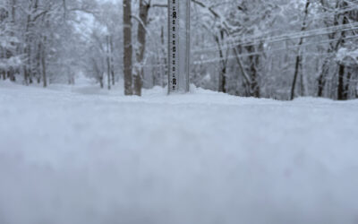
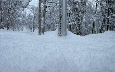
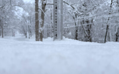
*35cm has fallen in the last 24 hours in Niseko. At 7:00 today the temperature was -8°C. Well the OYUKI arrived yesterday late afternoon and delivered an astounding amount of snowfall in a very short period. It is safe to say that the reading on the 360niseko station is not indicative of how much came down! With the strong prevailing winds the snow has not accumulated on the snow station. It is difficult to put a figure on just how much came down but feel confident in saying between 35-45cm…at least! Suffice to say it will be deeeeeeeeeeeeeep up there today. For those in the Niseko region you better hope your snow clearer has been able to clear your road or otherwise you will be snowed in! On the mountain please keep an eye on your fellow skiers and boarders as it will be easy to get buried in deep wind drifts!
Niseko Snapshots
As the storm struck last afternoon chaos ensured. Buses lots traction in the deep snow, the road heating count not keep up with the snowfall, strong winds creating deep wind drifts in minutes, limited visibility and about 40cm of snowfall coming down in around 1.5 hours. Apparently it was even worse in Kutchan with all hands of shovels to keep up with the crazy snowfall! Those who made it up for a ‘nighter’ reported all time conditions with deep powder – everywhere!
Useful information from other places
- Accumulative snow fall to date in Niseko, 242cm
- Snow depth at the peak, 220cm
- Snow depth at the base, 100cm
- Real time lift operations.
- JMA’s six hour precipitation forecast, possibly the most accurate weather map
- Snow Forecast 6 day weather summary
- The latest Niseko avalanche report.
Snow Forecast
360niseko Snow Station Readings Disclaimer
The 360niseko snow station is now in a new location for the 2016-17 between Hirafu and Higashiyama at 200m in altitude. There is 27m difference in altitude to last seasons position in lower Hirafu village 227m. *The Hirafu Gondola is at 305m. Please be aware that this new reading is NOT in Hirafu village but a few kilometers down the road. There is always a deviation how and where the snow falls – the area is famous for micro climates and mini weather patterns. Some days there may be 10cm in Annupuri and 25cm in Hanazono and vice versa – some days 30cm of fresh snowfall comes down everywhere!! Altitude plays a big part as well so please don’t take the 360niseko snow readings as being definitive – the readings are what is outside our house on the ground.


